San Francisco Bay Trail Risk Assessment and Project Prioritization Plan
SB1 Adaptation Planning Grant: Final Case Study
Summary
The East Bay Regional Park District (Park District) secured SB 1 Caltrans Adaptation Planning Grant Round 2 (2018-2019) funding to understand the future changes anticipated along the East Bay shoreline to develop the San Francisco Bay Trail Risk Assessment and Adaptation Prioritization Plan (SF Bay Trail RAAPP). This study evaluated the climate vulnerabilities facing the East Bay’s shoreline and assists the Park District in prioritizing nature-based adaptation projects to provide multiple benefits for the region. At a high level, the plan is focused on balancing goals related to advancing ecological restoration, recreation, critical mobility, and building important interpretive educational opportunities. The RAAPP also features several exemplar projects to demonstrate how the latest techniques related to coarse beach and marsh adaptation, for example, can be implemented over time to provide shoreline access as sea levels rise. By working with a wide range of experts, from research partners to local community stakeholders, the team has developed an integrated approach to adaptation planning and design that will benefit the community and broader region over time.
Lead Agency and Partnerships
As the lead agency, the Park District engaged with various stakeholders and identified opportunities to partner with cities and other organizations that share interest and would help advance key projects outlined in the RAAPP. The RAAPP focused on detailing potential partnership and funding strategies for each proposed site to ensure that a project was being designed with those factors under consideration. Key partners included City of Berkeley, the City of Alameda, and Caltrans.
Drivers 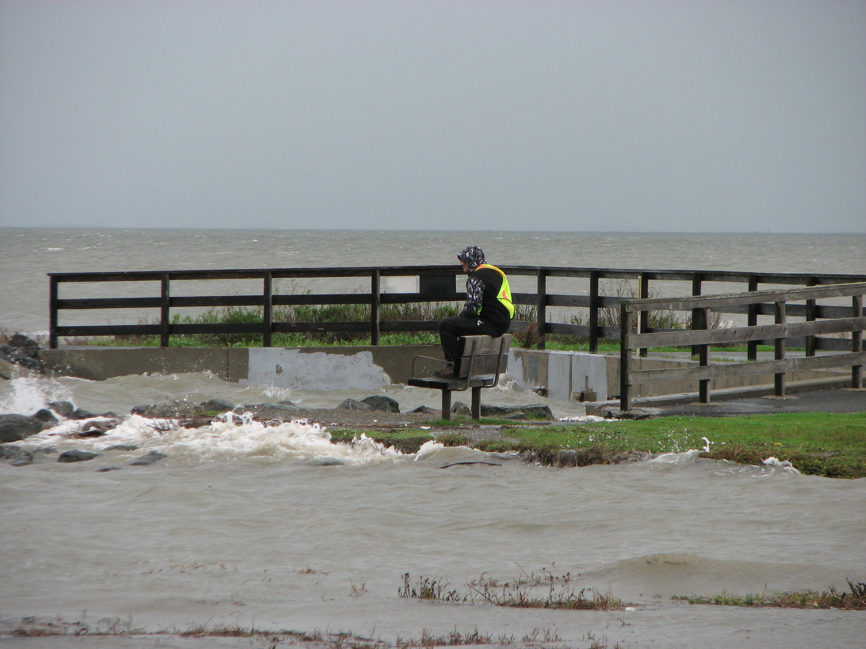
In 2018, one of the goals of the Park District’s operating budget was to “Plan for Climate Change Resiliency” which included a key indicator of “conduct a vulnerability assessment of the effects of climate change on public parklands.” As the Park District was recognizing the need to identify the vulnerability of its shoreline parks and adjacent critical infrastructure, a funding opportunity arose through the SB1 Caltrans Adaptation Planning Grant which allowed for an analysis of the SF Bay Trail through the development of the RAAPP. The RAAPP allowed the Park District to assess the risk to its shoreline recreational amenities and infrastructure in order to continue to uphold its mission of providing healthful recreation opportunities while protecting natural and cultural resources.
The Park District identified the following goals and priorities to guide the project:
- Resilience to Coastal Hazards
- Restoration Potential
- Minimize Recurring Maintenance
- Adjacency to Critical Infrastructure
- Serving Disadvantaged Communities
- Access to Nature/User Experience
- Funding and Partnership Potential
- Alignment with Park District Master Plan Goals and Priorities
- Representation of a diversity of coastal conditions and geographies
Engagement Process
Due to COVID-19 restrictions, all plans to do in person outreach which were scheduled for Spring and Summer of 2020 were canceled. The Park District hosted a public forum to discuss the two prototype sites and obtain community input in addition to partnering with Greenbelt Alliance to host a community forum to discuss regional sea-level rise efforts and showcase the RAAPP. More information is available at the following links:
- An interactive project website was created to engage public input.
- A full description of engagement is covered in a Summary of Stakeholder Engagement.
- Park District Forum: Community and Stakeholder Engagement Webinar
- Greenbelt Alliance Forum: The Future Climate - Rising to the Challenge - YouTube
Climate Impact Area
The project identified the system-wide climate change impact risks to multimodal transportation infrastructure by finding vulnerabilities and quantifying the impending threats to the Bay Trail. The goal of the RAAPP was to identify measurable and implementable actions and strategies to remedy identified climate related vulnerabilities and serve as a guide for the Park District to use on future sites with similar conditions.
The RAAPP examined storm inundation and tidal inundation with groundwater at multiple levels of sea level rise. The project also reviewed wind wave, restoration potential, disadvantaged communities, critical infrastructure, and park ownership. This evaluation led to the identification and evaluation of the top eight at-risk zones along the shoreline.
Funding Source
A $370,000 Caltrans Adaptation Planning Grant funded the RAAPP and the Park District’s staff time provided the local match. The Project was estimated to cost approximately $450,000 total.
Research and Data
The Park District used a diverse set of tools to conduct thorough research for the RAAPP. The tools included: Adapting to Rising Tides: Bay Shoreline Flood Explorer, Safeguarding California 2018 Update, State of California Sea-Level Rise Guidance 2018 Update, among others.
Challenges
Defining the scope of specific adaptation responses and strategies presented challenges. This was largely in part because of the mosaic of ownership along the shoreline. The Park District does not have continuous ownership along the shoreline and therefore needed to create adaptation strategies that would be successful even if neighboring segments remained untreated. To address the challenge, the Park District researched projects lead by other jurisdictions along the shoreline to ensure that the RAAPP was considering and building from the priorities of others and created an adaptation guide that was realistic and implementable.
Outcomes
The RAAPP goals were to:
- Identify which segments of the Bay Trail within the Park District’s jurisdiction need the most immediate attention to protect against sea-level rise
- Prioritize from a list of nature-based, implementable strategies and capital projects that will have both immediate and long-term co-benefits to the trail, shoreline, and adjacent communities
- Identify key partnerships and funding opportunities to implement the recommended projects and strategies.
Of the eight priority segments the RAAPP identified, three were further analyzed for additional constraints and funding opportunities and then prototype concept plans were developed for two sites. Key design considerations for these included:
- Views across the Bay
- High wave action
- Seasonal access to the Bay trail
- Contamination Sites
- Low elevations and inundation that pose a risk to existing structures, but can be planned as a benefit for marsh and habitat creation
- Nature-based shoreline stabilization opportunities
- Integration with Berkeley Meadow restoration
- Opportunities for green infrastructure
- Key coordination to provide resilient access and habitat areas through end-of-century
Replicability
The goal of the RAAPP was to create a suite of adaptation techniques that can be incorporated in future trail adaptation projects. The adaptation strategies may be replicated along segments of the Bay Trail with similar site criteria.
Additional Resources
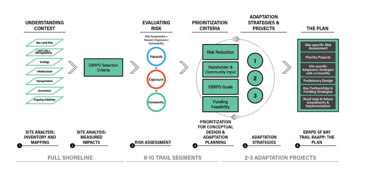
The graphic below showcases the RAAPP development process. This may be helpful for organizing other studies with similar scope. Additionally, the project team developed a storymap to showcase the results of the RAAPP.
The project team also examined funding and partnership strategies for key project areas, which are outlined in a Funding and Partnership Strategy Memo.
Further Information
Devan Reiff at (510) 544-2325 or dreiff@ebparks.org
Principal Planner, East Bay Regional Park District