Alameda's Climate Action and Resiliency Plan
SB1 Adaptation Planning Grant: Final Case Study
Brief Summary 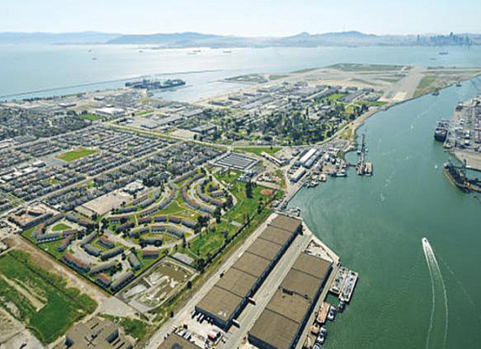
Alameda’s Climate Action and Resiliency Plan (CARP) is an update to the City’s 2008 Local Action Plan for Climate Protection. The CARP was developed in a partnership between staff, community members, and nonprofit organizations over a 15 month period. Technical assistance was provided by a consulting firm. The CARP defines goals for climate adaptation and mitigation, analyzes the gaps and challenges needed to overcome in order to achieve those goals, and presents recommended actions that can be taken by the City, community, and partner agencies for realizing those goals.
Work commenced in May 2018 and City Council adopted the CARP September 2019.
GHG reduction targets of 50% below 2005 levels by 2030 and net zero emissions as soon as possible are consistent with California’s statewide legislative target of 80% reduction in emissions below 1990 levels by 2050 and executive order target of carbon neutrality by 2045.
The adaptation portion of the CARP followed sea level rise (SLR) projections and guidance put forward by the State Ocean Protection Council. In accordance with the goals of Safeguarding California, the CARP considered all climate hazards and put a central focus on community engagement and social equity.
The CARP created a Social Vulnerability Assessment (SVA), which mapped the concentration of socioeconomic indicators that affected a household’s ability to prepare for, respond to, and recover from a natural hazard event across Alameda’s 57 Census block groups. The SVA gave the City insight into which neighborhoods need extra assistance in order to avoid disproportionate impacts from hazard events, and served as a proxy for a more granular version of a disadvantaged communities index than what is provided by CalEnviroScreen.
The CARP created a planning framework for climate adaptation in Alameda that prioritizes natural infrastructure and ecologically beneficial adaptation projects. Several nature-based adaptation solutions were described as options for Alameda’s priority flooding locations, however no specific designs were approved as part of the planning process.
The CARP combines mitigation and adaptation through a framework referred to as the “Climate-Safe Path”. This approach seeks to adapt to climate change according to projections of impacts put forth by the State of California while contributing to a global lowering of the warming curve by aggressively cutting local emissions, pursuing innovative GHG reduction projects, and collaborating with other local, regional, and State agencies as much as possible.
Key components of the CARP include a vision statement; goals for GHG reduction, climate adaptation, and capacity building; a gap analysis for GHG reductions and new actions that close the gap to Alameda’s goals; a climate vulnerability analysis by sector and geography; resilience actions to mitigate climate hazards; an economic analysis of the benefits and costs of climate adaptation investments, and plans for implementation, periodic re-evaluation, and key metrics to track progress. The appendix to the plan includes an economic analysis that complies with AB 691 requirements.
Lead Agency and Partnerships
The lead agency was the City of Alameda. Consulting assistance was provided by the Eastern Research Group. Project funding was provided by a CalTrans SB1 Adaptation Planning grant, an associated local match and other programmatic funding.
Local community-based organizations assisted with outreach, community engagement, and developing actions for the plan. These included Community Action for a Sustainable Alameda, Bike Walk Alameda, and a local chapter of the Sierra Club. A Task Force of community representatives provided advice on engagement throughout the process. The Task Force included the CBOs above as well as representatives from City Boards and Commissions, neighborhood associations, and local business and realtor groups.
External agencies engaged in the planning process because of their regulatory role, property along Alameda’s shoreline, and/or climate expertise included: BAAQMD, BCDC, Caltrans, the Coastal Conservancy, EBPRD, EBMUD, and Stopwaste.
The funding provided by the SB1 Adaptation Planning grant made the entire project possible. The community perspectives provided by the Task Force were also highly valuable in helping the CARP staff team develop and communicate a plan that represented community interests.
Drivers
This project complies with SB 379 and has a focus on social equity similar to what is required by SB 1000. However the project was driven by a local desire to update Alameda’s 2008 climate action plan, not by legislation or mandate at any level of government.
The CARP originated from a City Council referral to update the 2008 Local Action Plan for Climate Protection. This Council referral, as well as the original effort in 2008, were spurred by community advocacy.
Project staff made efforts to give community members a primary role in proposing, refining, and approving the CARP’s recommended actions, beginning early on in the planning process.
The project was primarily funded by the SB 1 Caltrans Adaptation Planning Grant Program.
Engagement Process
Stakeholders in the engagement process included entities such as Caltrans, East Bay Municipal Utility District, East Bay Regional Parks District, BAAQMD, Port of Oakland, City of Oakland, Alameda Municipal Power, CASA, and other local community groups. The vulnerable populations benefited by this project include all residents of Alameda, because of the island’s roadway, tunnel, and bridge infrastructure predicted to be compromised by rising sea levels. All egress routes for Bay Farm Island are entirely blocked under elevated sea level conditions. For disadvantaged areas within the City, such as Alameda Point, the City partnered with Alameda Point Collaborative, a supportive housing community that helps families and individuals break the cycle of homelessness and poverty.
The City gathered significant public input through three interactive community workshops that were the driving factor of the planning process. These workshops provided co-benefits such as outreach and discussion with vulnerable neighborhoods, including transit-dependent populations and disadvantaged communities. In addition, stakeholders offered technical assistance as well as education on current vulnerabilities and any relevant initiatives. They helped vet potential strategies and increased the likelihood of successful adoption and implementation.
The three community workshops were structured with the first focused on project goals and objectives, the second on the community-preferred priorities and alternatives for GHG mitigation and adaptation strategies, and the third on public comment on the draft Climate Action Plan update. The community also identified adaptation pilot projects to pilot and launch.
The outcomes of the engagement process included community input on goals and objectives of the project, identification of priority strategies and alternatives, and identification of pilot projects.
Vulnerable populations were identified using the Social Vulnerability Assessment, according to 10 socioeconomic indicators provided by ABAG through their Stronger Housing, Safer Communities plan.
The CARP received widespread support from the community members and partner agencies who spoke when it appeared before Alameda City Council.
Climate Impact Area
The CARP’s vulnerability assessment and resilience actions addressed the climate impact of shoreline and inland flooding and sea level rise (tidal/storm, stormwater, groundwater sources, levee breaches). It also considered extreme heat, drought, and the effects of hazardous air quality from being downwind from fire-prone areas and wildfire smoke, as well as the nexus with earthquakes (particularly looking at liquefaction risk). This project evaluated the impacts of flooding and sea level rise scenarios, including predicted reduced access to transit, impacts to transportation infrastructure and open space, loss of circulation for emergency vehicles, commuting, and commerce, lack of access to hospitals, lack of functional schools/education, lack of access from mutual aid outside of the City, permanent loss of displaced population, industry, and commerce, and health concerns from contaminated flood water and groundwater.
The project built upon completed works, such as the City's 2016 Local Hazard Mitigation Plan and the 2014 Adapting to Rising Tides Study, filled knowledge gaps, and yielded an implementable list of actions to increase resiliency. The indicators to measure success were developed during the planning process, and greenhouse gas reduction will be fully integrated into the process.
Funding Source
In addition to the funds provided by the SB 1 adaptation planning grant, the project was funded by Alameda’s stormwater fund, integrated waste fund, general fund and tidelands. The total project budget was $600,000, which included a groundwater modeling exercise and report.
Research and Data
The project drew on many planning resources, including Cal Adapt, Safeguarding California, OPC Sea Level Rise Guidance, Adaptation Planning Guide, Adapting to Rising Tide, among others. The metrics used to track progress were decided during the planning process, and were developed in a CARP dashboard that was not part of the plan itself but was developed in the first few months of implementation.
Challenges
A major challenge was completing this comprehensive and ambitious plan in a shorter timeline (approximately 15 months) than many other cities followed for similarly sophisticated plans.
The solution was to delegate certain tasks to implementation (such as the groundwater study) rather than allowing the project scope to continue to inflate as the project went on.
Outcomes
The CARP’s economic analysis that the benefit-cost ratio of sea level rise adaptation in different scenarios ranged from $3.5:1 to $8:1, using a methodology that excluded certain benefits because they were difficult to quantify.
Next steps include a study of groundwater risks and adaptation responses, a communications plan, an urban forestry plan, additional planning work at the City’s highest priority flooding locations, and a CARP dashboard.
Replicability
The Social Vulnerability Assessment could be replicated, as could our approach to community engagement which included a combination of digital and in-person outreach. The approach to sea level rise adaptation focused on areas affected soonest and with greatest consequence, and offered phased adaptation options as SLR advances. Many of the GHG reduction actions could be used in other jurisdictions.
Additional Resources
Further Information
Erin Smith or Patrick Pelegri-O’Day
esmith@alamedaca.gov or ppelegrioday@alamedaca.gov