Santa Barbara County Multi-Modal Transportation Network Resiliency Assessment
SB1 Adaptation Planning Grant: Final Case Study
Summary
Located on the Central Coast of California, Santa Barbara 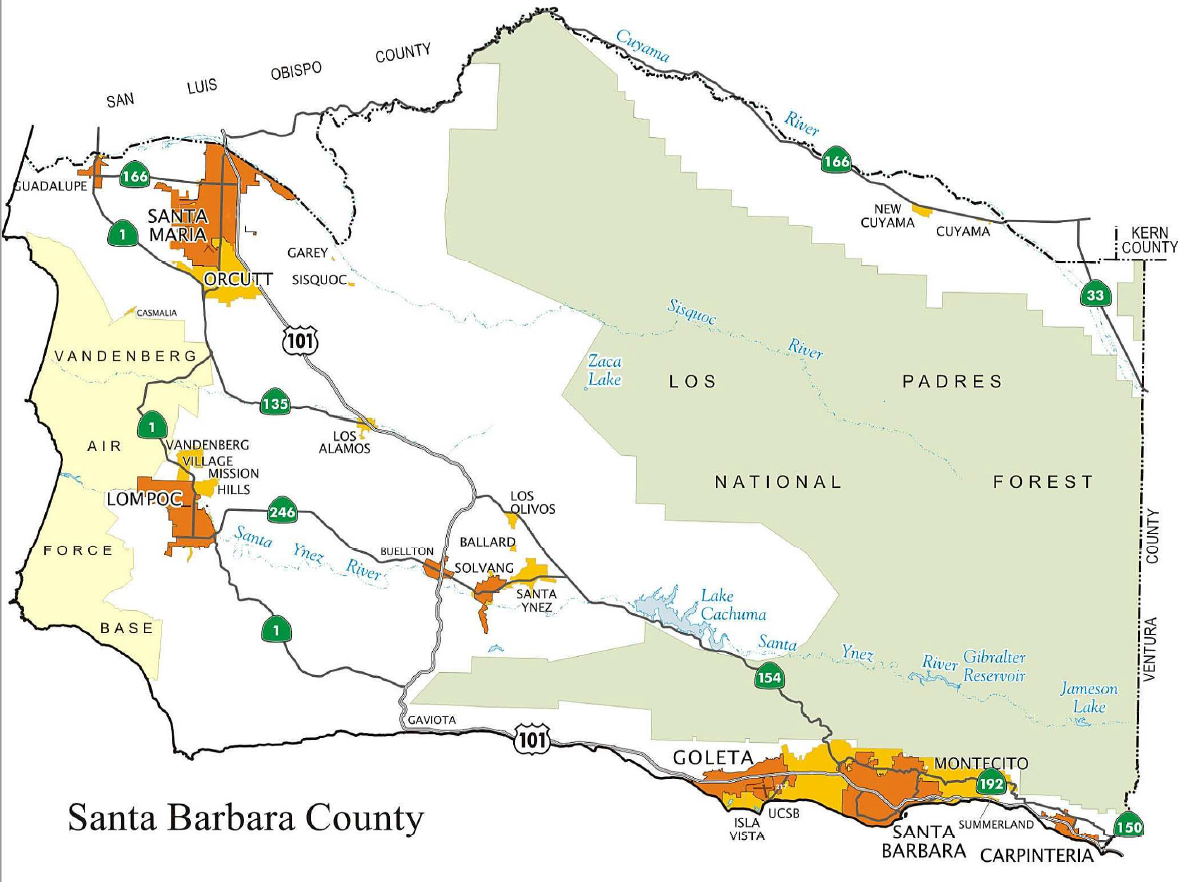 County contains eight incorporated cities, as well as the Santa Ynez Band of Chumash Indians - a federally recognized tribal government located in the Santa Ynez Valley. Beginning in fall 2018, Santa Barbara County Association of Governments (SBCAG) worked with a consultant, Energetics, and a local non-profit, the Community Environmental Council, to develop a multi-modal transportation network resiliency assessment for the region. SBCAG worked with the consultant team and a local technical advisory group (the Climate Resiliency Team) in developing a regional Vulnerability Assessment, which identified transportation assets and infrastructure that are vulnerable to climate change hazards (such as sea level rise, flooding, wildfires, erosion and landslides). The findings of the Vulnerability Assessment were then utilized in a Regional Climate Adaptation Strategies (RCAS) document that developed four overarching strategies for the region and identified a portfolio of adaptation resilience measures for consideration for SBCAG partner agencies and jurisdictions. The recommendations from the study will be incorporated into the next update of SBCAG's Regional Transportation Plan-Sustainable Communities Strategy (RTP-SCS).
The assessment supports several ongoing State initiatives and priorities, including priorities of the California Transportation Plan on recommending best practices for adaptation and resiliency and linking adaptation planning and programming at the regional level. Implementation of the strategies and adaptation measures identified in the RCAS would make the region more resilient to the impacts of climate change by protecting natural systems and expanding transportation options. As noted in the California Air Resources Board's Vibrant Communities and Landscapes (September 2016), "protected and managed natural systems can mitigate impacts of floods, protect water quality and supply, enhance food security, and protect against other climate impacts."
Lead Agency and Partnerships
As the project lead, SBCAG has been able to leverage its role as the Metropolitan Planning Organization/Regional Transportation Planning Agency (MPO/RTPA) to facilitate partnerships at the local and regional level for this project. The Community Environmental Council worked closely with SBCAG to facilitate working with the Climate Resiliency Team, which consisted of planning staff from the local cities and the County, CalTrans, community-based organizations, school staff, emergency response organizations, and other non-profit organizations.
Drivers
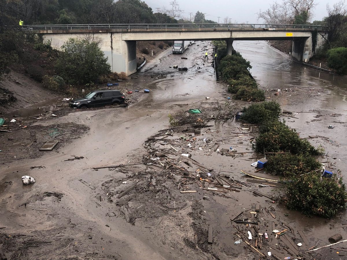
Increases in large fire occurrence have already been observed in the region and are projected to continue. In December 2017 the region experienced the largest recorded fire in state history at the time, which was followed by a severe rain event on January 9, 2018. Due to the sheer magnitude of burnt vegetation, flash floods and mudflows resulted in loss of life and injuries, as well as major property damage in the region. The event delayed emergency response and resulted in major road closures and disruptions to regional and local transit services and rail. The closure was a major event, disrupting daily commute patterns for approximately 13,000 workers commuting from Ventura County to jobs in Santa Barbara County that rely on the transportation network.
Funding Source
The project was funded by an SB1 2017/18 Adaptation Planning grant referenced above for $100,000, and supplemented by a local match.
Engagement Process
SBCAG worked with the Community Environmental Council (CEC) to assemble and facilitate a discussion and conversation with the Climate Resiliency Team around climate change vulnerabilities and adaptation issues in the region. Two meetings were convened with the CRT; the first focused on building relationships amongst staff and the team members and data-sharing, while the second focused on engaging feedback on the draft Vulnerability Assessment and identifying potential resilience measures where these vulnerabilities exist.
Climate Impact Area
The study area for the project was the entirety of Santa Barbara County. The primary climate change hazards identified in the Vulnerability Assessment for the region include sea level rise in the form of nuisance flooding and storm surge flooding, and inland hazards such as increased wildfire occurrences, landslides, and fluvial flooding.
Research and Data
The consultant for the study, Energetics, compiled and relied on a number of local data sources and studies in developing the Vulnerability Assessment, including the City of Santa Barbara Sea Level Rise Adaptation Plan, Vulnerability Assessment Update (2018), the County of Santa Barbara Sea Level Rise Coastal Resiliency Project Phase 2 (2016), and the Goleta Slough Management Committee Goleta Slough Management Plan (2016). In preparing the Vulnerability Assessment, Energetics relied on a number of data sources, including the USGS Coastal Modeling System (CoSMoS), Ocean Protection Council (OPC) parameters for defining scenarios, California’s 4th Climate Change Assessment (C4CCA), FEMA Flood Insurance Risk Maps (FIRM), and CalFire Fire Hazard Severity Zone maps.
The consultant utilized a scenario-based approach, recommended by the state (C4CCA & OPC), using a Low Emissions (RCP 4.5) and High Emissions (RCP 8.5) scenario for future time horizons (2030, 2055, 2085) and varying scenarios for sea-level rise (0.25 meters in 2030, 0.75 meters in 2060, and 2 meters in 2100; as well as a “low-risk aversion” scenario in 2100 of 0.75 meters). The vulnerability assessment utilized a risk-based prioritization method to determine which high-priority transportation systems were most at-risk to the threats from climate change in our region.
Challenges
The results of the risk-based prioritization in the Vulnerability Assessment indicate that, by mid century (2060), most high risk vulnerabilities are associated with precipitation-related hazards to infrastructure in the coastal zone, specifically, the Santa Barbara Airport and the Union Pacific Railroad. A much greater share of transportation infrastructure will be affected by sea level rise hazards by the end of the century, including the US 101 route in the South Coast area.
One of the recommendations of the RCAS is that there are three major pieces of transportation infrastructure for which strategies need to be developed to deal with future impacts of climate change, 1) the Santa Barbara Airport, 2) the Union Pacific Railroad, and 3) US 101. The RCAS includes a portfolio of potential resilience measures for various locations throughout the region, but is not “prescriptive” in recommending one over the other (Appendix A). The portfolio also lists out potential costs which, in most cases, are expensive and, in some cases, would involve a collaborative planning process to fund and build. There are currently limited state and federal funding sources for climate change mitigation projects for infrastructure.
Outcomes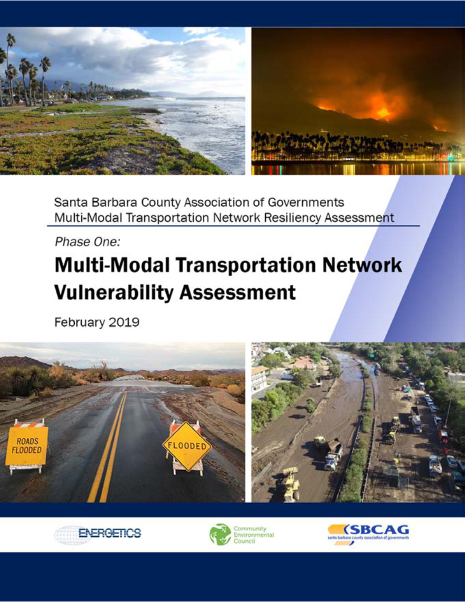
The Regional Climate Adaptation Strategies document identifies potential resilience action measures that could be implemented. In addition, four overarching strategies are identified for the region:
- Safeguard coastal infrastructure from flooding and erosion
- Create a long-term plan for the Santa Barbara Airport
- Ensure access and mobility during emergencies
- Targeted hazard analyses of critical threats
SBCAG will need to work with its partners and the community in the future to implement these adaptation strategies in its long-range transportation plan (RTP-SCS) and by other means.
Replicability
The process SBCAG has undertaken can be replicated by other MPOs or RTPAs across the state. Vulnerabilities may be unique to each geographic region, but the suite of adaptation measures identified is comprehensive and can be utilized across for most any coastal region.
Additional Resources
- Transportation Network Resiliency Assessment Web Page and Documents
- Caltrans Adaptation Planning Grant Application – Santa Barbara County Transportation Network Resiliency Assessment
- SBCAG Fast Forward 2040 Regional Transportation Plan-Sustainable Communities Strategy (RTP-SCS)
For additional resources refer to “References” in the SBCAG Vulnerability Assessment.
Further Information
For additional information regarding the resiliency assessment, contact: