Highway 1 Corridor in Tam Valley Transportation Resilience
SB1 Adaptation Planning Grant: Final Case Study
Summary
The Marin County Public Works developed resilient adaptation options for current flooding and fut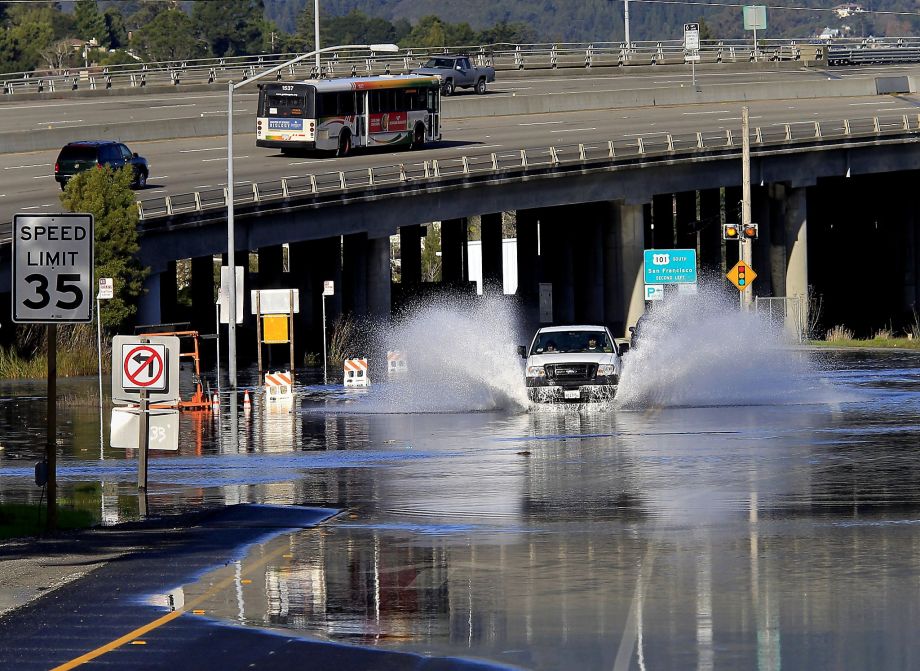 ure sea level rise in Richardson Bay, Marin County, California. Regular flooding occurs with high tides and is made worse with storm events and future sea level rise. The areas impacted include portions of State Route 1, U.S. Highway 101, the Mill Valley-Sausalito Multiuse Path, the Manzanita and Pohono Park and Rides and the transit stops at those locations. The scope of work was developed to coordinate several efforts in the project reach to understand the issues and options for adaptation for the entire reach. Key data gaps and solutions were developed for reaches at the Manzanita/Pohono shoreline and for lower Coyote Creek at Bothin Marsh. Several past studies and newer planning efforts in the area were leveraged for the grant.
Richardson Bay in Marin County is known for its dramatic landscape from the iconic views of Mt. Tam to the dynamic conditions along the Bayshore. Climate change poses serious challenges to many of the public agencies and private landowners that are responsible for maintaining and ensuring the safe use of roads, trails, open spaces, buildings, and critical infrastructure. The impacts also extend beyond the immediate shoreline to affect the entire community.
|
While sea level rise impacts all of Marin, this effort is scaled to a portion of Richardson Bay adjacent to the intersection of US 101 and SR 1. Funding from Caltrans focused the work on the transportation corridor served by the highways and nearby roads, and the Mill Valley-Sausalito Multiuse Path. This location serves as a gateway to Mount Tamalpais, West Marin, and provides access to the communities of Sausalito, Marin City, Tam Valley, Homestead Valley, Almonte, and Mill Valley. The Mill Valley Sausalito Bike Path is the most used trail in the county and serves both recreational users, students to several nearby schools, and commuters. Addressing adaptation options for climate change, primarily sea level rise, is needed for the main transportation corridors, but any solution is directly connected to the surrounding communities and requires a coordinated effort to develop alternatives.
For additional information, explore the Richardson Bay Resilience story map. The story map compiles the sea level rise background, impacts on transportation corridors, existing studies, and adaptation alternatives for the Marin City, Manzanita, Tam Valley, and Miller Avenue areas.
Lead Agency and Partnerships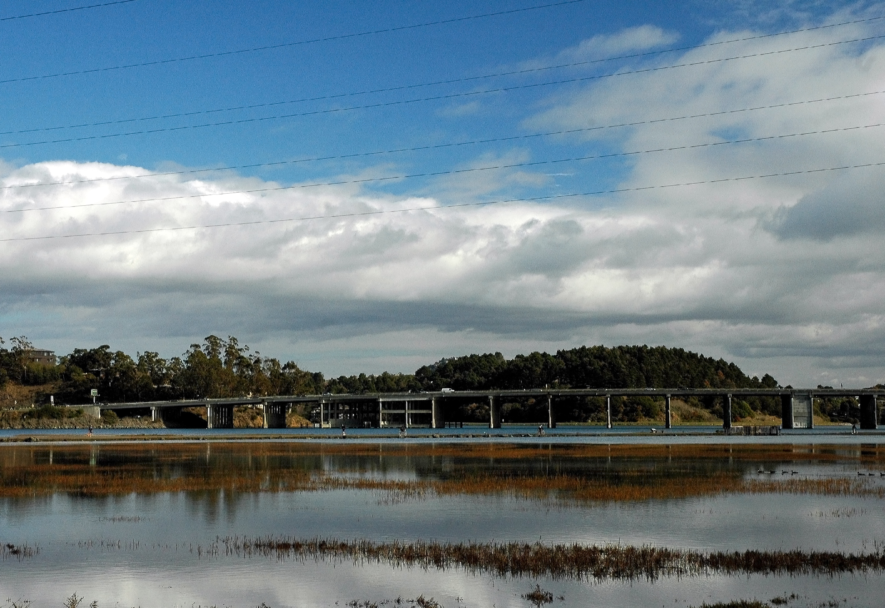
Marin County Public Works served as the lead on the grant. County staff worked with a coalition of Marin County Parks Department and Golden Gate National Parks Conservancy staff. The Parks Department and the Conservancy led the effort to plan for climate impacts in Bothin Marsh, which runs along the shoreline of the project area. Additional partners included Caltrans, the Transportation Authority of Marin, and local stakeholders in the surrounding communities. Additional coordination with environmental non-profits, neighborhood groups, and sea level rise-interested parties took place over the course of the grant.
Drivers
The community identified the need to develop solutions that support a variety of uses for the area. The SB1 Adaptation Planning Grant was a key driver in consolidating existing sea level rise planning efforts developed by different agencies on conflicting timelines. SB1 Adaptation Planning Grant funding helped partners and community stakeholders share vital information to identify an adaptation plan with the necessary partners and community stakeholders.
Engagement Process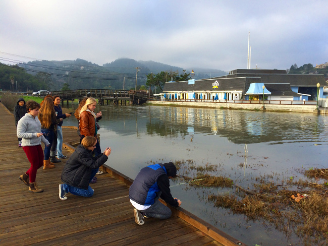
While the entire community was the target for outreach, specific user groups were identified and targed for outreach. User groups included the trail users, such as: commuters and recreational users; those using the roads through the corridor; students and staff at the middle and high schools; environmentalists; those concerned with flooding along Coyote and Arroyo Corte Madera del Presidio Creeks; and the businesses along both sides of the road.
The County led outreach in a number of specific areas related to this grant: flood control, sea level rise, Bothin Marsh, and city and county-specific projects along the trail and road(s). Staff worked through Bothin Marsh engagement efforts, sea level rise steering committee meetings, and through community-led meetings to share information and solicit input about concerns and possible alternatives to inform the planning and adaptation process. With COVID-19, the planned public meetings shifted to an interactive story map with surveys to collect input. The grant’s outcomes highlight specific local adaptation options and emphasize the coordination needed to plan for the larger shoreline reach.
Climate Impact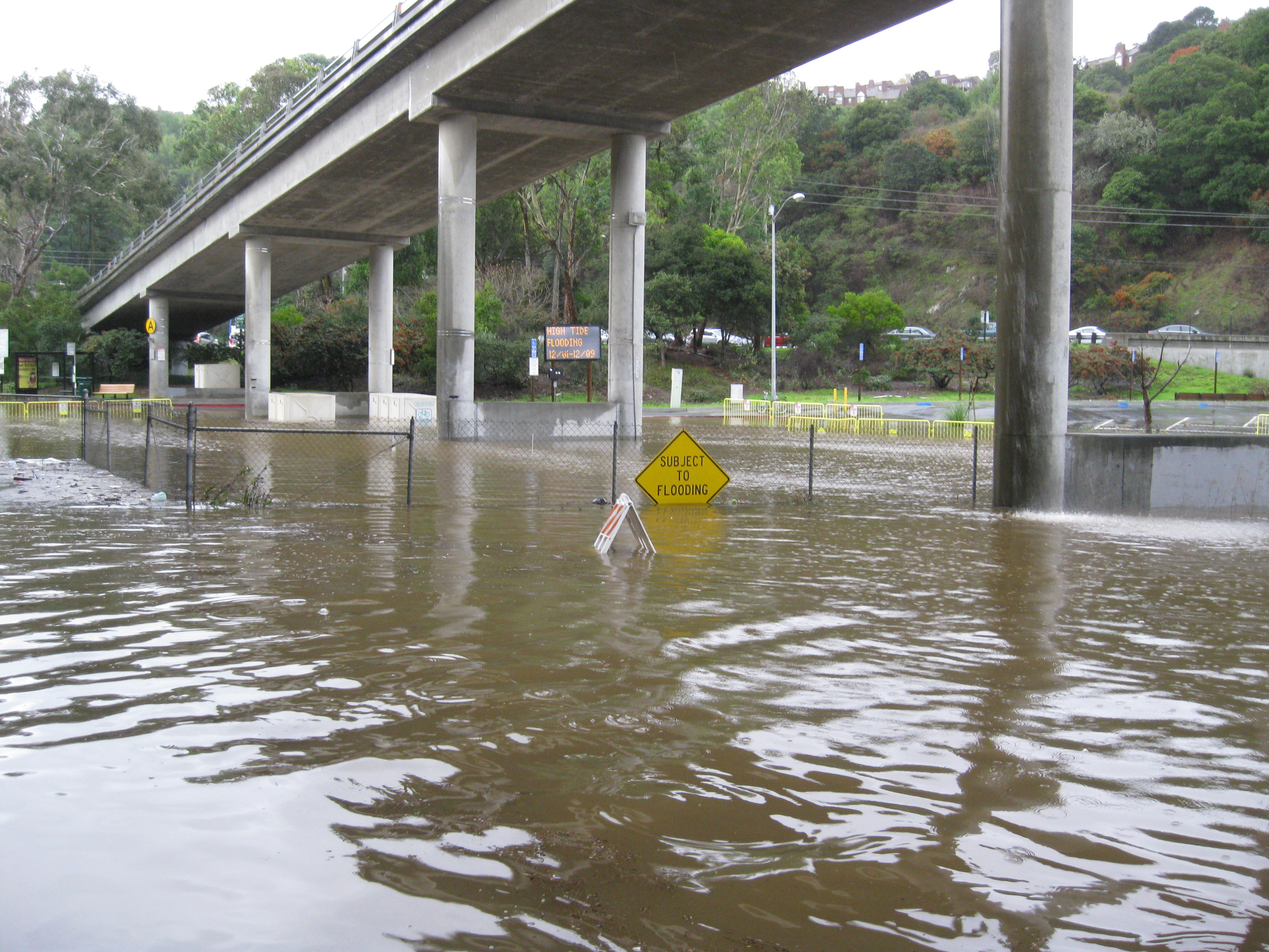
The objective of the project was to develop strategies and concept-level ideas that improve resilience to tidal and storm-surge flooding in Marin County to protect the area between the intersection of State Highways 101 and 1 north to Mill Valley. The stretch of waterfront frontage is subject to sea level rise and regular flooding at high tide. Several key transportation linkages are at risk: State Highways 101 and 1 (including the on- and off-ramps), Marin County and City of Mill Valley portions of Almonte Road, Caltrans’ Manzanita and Pohono Park and Ride lots and transit connections, and Marin County’s Mill Valley-Sausalito Multiuse Path. State Highway 1 and Almonte Boulevard serve residents of Mill Valley, Sausalito, and Marin City (a disadvantaged community), and are the primary access route to Tam Junction, Almonte, and West Marin (including state and national parks). Sea level rise creates additional vulnerability and will eventually lead to permanent inundation of the area. The Mill Valley-Sausalito Multiuse Path, the most heavily-used commuting and recreational path in the county, was built on a former railroad bed and sections become submerged with high tides. The multi-use trail forms a levee and impacts the health of the wetland by limiting flow from the bay and Coyote Creek.
Climate impacts are mostly driven by sea level rise considerations, however, the flooding of the pathway and the loss of key transit corridors for buses, shuttles, pedestrians, and bicyclists will also continue to impact GHG emissions.
Funding Source
The project was funded through a $400,000 grant from theCaltrans SB1 Adaptation Planning Grant Program and a local match totaling $115,000 from the Transportation Authority of Marin and the Flood Control Zone No. 3. The total project budget was $515,00.
This project built upon completed sea level rise and flood studies and projects funded by the County of Marin, State Coastal Conservancy’s Climate Ready Grant Program, Flood Control Zone No. 3, and Marin County Parks Measure A funds.
Research and Data
This project utilized data from the 2017 Marin Shoreline Sea Level Rise Vulnerability Assessment, which includes infrastructure data on roads, pipes, and other utilities. It also supported long-term work in Flood Control Zone No. 3 and Coyote Creek studies as well as Marin County Parks’ work on Bothin Marsh.
Two new 2D HEC-RAS models were developed to assess alternatives at Bothin Marsh and in the reach along Sausalito to Coyote Creek. These models included updated LiDAR data from 2019 and collected additional data with ground surveys to gather data where LiDAR was not sufficient. Model outputs are included in the story map and shared as videos and images.
Challenges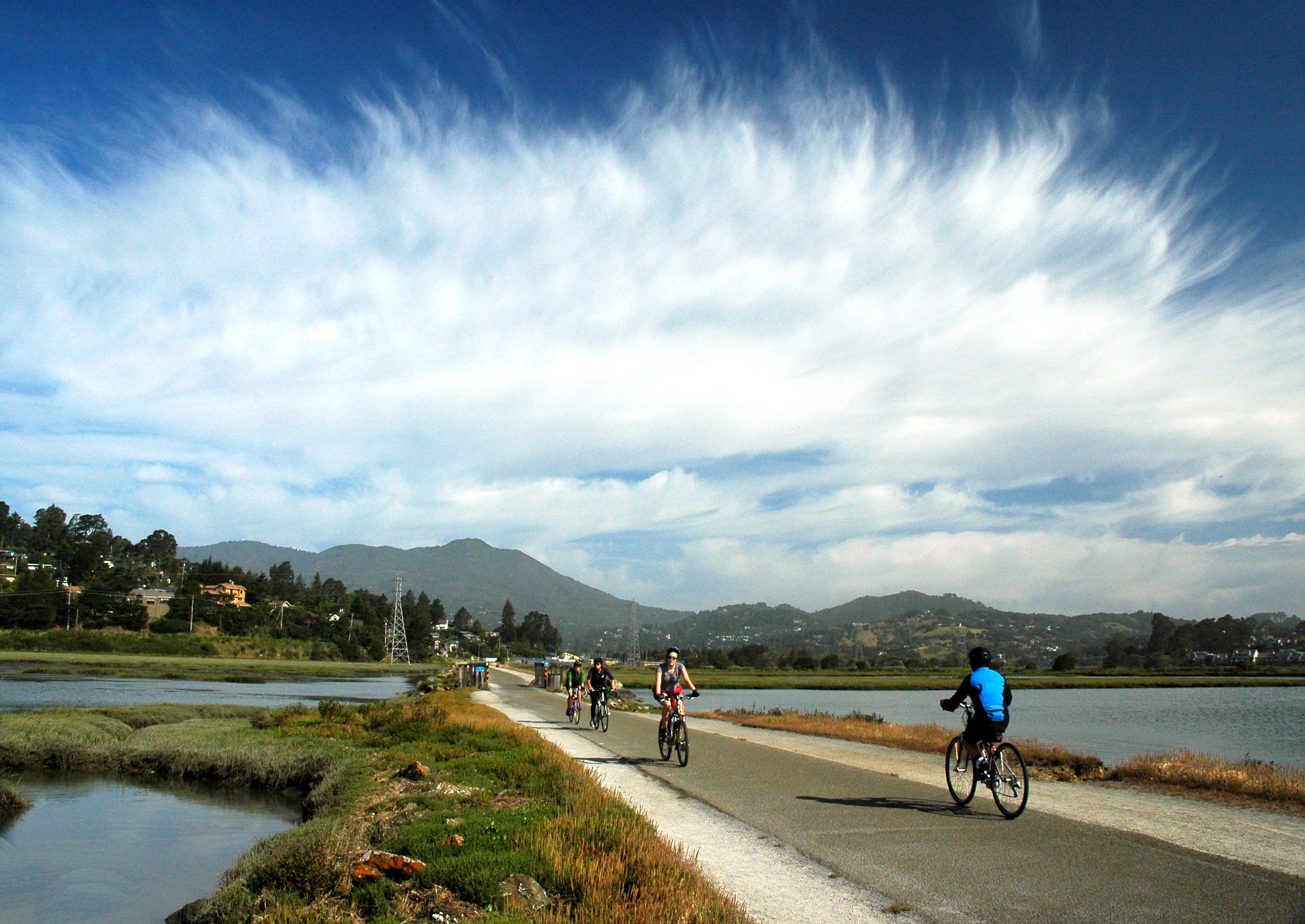
COVID shifted engagement from interactive sea level rise planning in public meetings to an entirely online story map. While early meetings were not impacted, the final input from the public on alternatives and issues were received through an online survey and virtual meetings.
Adptation planning continues to be an ongoing process and the grant created a forum for future engagement. Public engagement will continue for the Bothin Marsh project and local community efforts in Marin City, Sausalito, and Tam Valley have emerged that will be supported by Marin County in developing solutions.
Outcomes
The main goal of this project was to identify possible adaptation solutions to sea level rise. The focus area was transportation assets, which include the state highway, some local roads, and the Mill Valley-Sausalito Bike Path, however, the project anticipates using the natural resources in the area to maximize habitat, increase community resilience, and provide relief to the stormwater flows towards the Manzanita Park and Ride.
Outcomes of the project:
- Short-term solutions were developed for the shoreline reach between Gate 6.5 and Coyote Creek. These were focused on sunny day high tide flooding, though the model developed can be used to add storms and additional sea level rise scenarios
- Coyote Creek alignment impacts were modelled and reported to assist the Bothin Marsh project. The lower Coyote Creek channel could support the resiliency of the marsh with sediment deposits and a more natural channel alignment.
- Mill Valley-Sausalito Multiuse Path maintenance recommendations and final plan set for implementation. This task is currently awaiting permits from the resource agencies.
- Development of an online story map to share the factors in planning for Richardson Bay Resilience.
Replicability
The process itself is fairly replicable, but dependent on community support and partnerships. Other local jurisdictions struggling to prepare their communities and their major statewide transportation assets for the impacts of climate change, sea level rise, and flooding may benefit from replicating Marin County’s efforts.
Additional Resources
Project information will be updated on the www.MarinSLR.org website and also on the www.MarinWatersheds.org site.
The Marin County sea level rise vulnerability assessment can be found here: https://www.marincounty.org/main/marin-sea-level-rise/baywave/vulnerability-assessment
Further Information